| |
Geomagnetism |
|
| Home | Magnetic Field Overview | Model and software downloads | Online Calculators | Magnetic Data Sources | Geomagnetic Tutorials |
|---|
Magnetization of the lithosphere gives rise to a magnetic field which can be mapped by low orbiting satellites, as has been demonstrated by the POGO (1967-1971) and Magsat (1979-1980) missions. Following 20 years without suitable measurements, a continuous flow of high quality data from the CHAMP satellite is currently opening a new era in the mapping of lithospheric magnetic anomalies. A further significant step forward is expected with the gradient measurements of the upcoming Swarm satellite constellation mission.
The magnetization of the lithosphere is due to magnetic minerals, primarily magnetite with varying content in titanium. These titano-magnetites have Curie temperatures of 400 C - 600 C, above which they become essentially non-magnetic. Therefore, the lithospheric magnetization is limited to a layer of about 10 km - 50 km in thickness, depending on the local heat flow.
Of the lithospheric magnetic field, only wavelengths shorter than 2500 km are visible. The longer wavelengths are overshadowed by the much stronger magnetic field generated in the Earth's outer liquid core. What is generally referred to as the lithospheric magnetic field is actually only its shorter wavelength part. This is why some large-scale signatures, such as those of the North American and the Baltic shields are chopped up into smaller anomalies. The lithospheric field scales with the strength of the main field, hence, is particularly weak in the South Atlantic Ocean and strong in the Polar Regions.
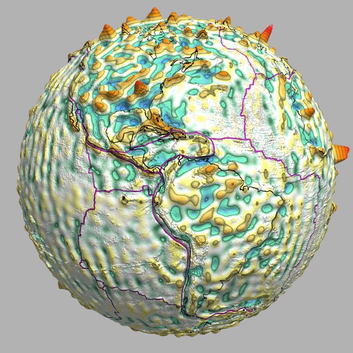
Fig.1 Lithospheric magnetic field as given by the MF4 model produced from CHAMP satellite data. Displayed is the vertical component of the magnetic field, downward continued to 100 km altitude above the surface of the Earth. This image is also available as an animation on the MF4 model page.